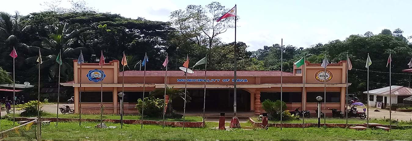
100 UNITS NAGA SAMAL IDIGENOUS PEOPLE HOUSING PROJECT

Read more: Turn-over and Awarding Ceremony of NHA Housing Project
The 1995 Mid-Decade Population Count of the municipality showed that the town has a total population of 31,421. For year 2000 base on the National Statistics Population Census the result was 35,176 with household number of 6,468. And for the year 2005, it has a total population of 38,780 with household number 7,211. For year 2007, it has a total population of 40,323 with household number 7,517. For 2008, it has a total population of 41,117 with 7,663 numbers of households and 2009, it has 41,927 population and 7,813 households. For year 2016, it has a total population of 41,117 and 7,663 Household number, in year 2017 it has a total population of 37,054 with a total household 8,361, Out of the total population of the municipality 48.34% are females and 51.66% males. It has an annual growth rate 2.09 following the growth rate of the province. The age distribution of Naga is evidently young with 20,521 (57.63%) aged 0-24 years old, 15,044 (40.60%) aged 25-65 years old only 1,489 (4.01 %) are above the 65 years old bracket.
Total Population as of August 1, 2017 (Source: CBMS)
|
NAME OF BARANGAY |
NO. OF HH (Estimated) |
2017 POPULATION |
HH SIZE |
|
AGUINALDO |
394 |
1,728 |
4 |
|
BAGA |
383 |
1,635 |
4 |
|
BALUNO |
307 |
1,599 |
5 |
|
BANGKAW-BANGKAW |
151 |
767 |
5 |
|
CABONG |
105 |
405 |
4 |
|
CROSSING STA. CLARA |
567 |
2,351 |
4 |
|
GUBAWANG |
141 |
641 |
5 |
|
GUINTOLOAN |
284 |
1,277 |
4 |
|
KALIANTANA |
420 |
2348 |
6 |
|
LA PAZ |
402 |
1,985 |
5 |
|
LOWER SULITAN |
195 |
744 |
4 |
|
MAMAGON |
402 |
1,898 |
5 |
|
MARSOLO |
424 |
1,754 |
4 |
|
POBLACION |
584 |
2,707 |
5 |
|
SAN ISIDRO |
383 |
1,452 |
5 |
|
SANDAYONG |
420 |
1,978 |
4 |
|
SANTA CLARA |
1890 |
1,890 |
4 |
|
SULO |
739 |
3,085 |
4 |
|
TAMBANAN |
359 |
1,497 |
4 |
|
TAYTAY MANUBO |
279 |
1,272 |
4 |
|
TILUBOG |
242 |
1,065 |
4 |
|
TIPAN |
316 |
1,489 |
5 |
|
UPPER SULITAN |
379 |
1,487 |
4 |
|
TOTAL |
8,361 |
37,054 |
4 |
No. of informal settlers – households: 1,803 HH
|
BARANGAY |
2016 POPULATION |
2016 NO. OF HH |
2017 POPULATION |
2017 NO. OF HH |
|
1. POBLACION |
3,957 |
811 |
1,728 |
394 |
|
2. AGUINALDO |
1,536 |
313 |
1,635 |
383 |
|
3. BAGA |
1,861 |
340 |
1,599 |
307 |
|
4. BALUNO |
1,563 |
301 |
767 |
151 |
|
5. BANGKAW –BANGKAW |
853 |
143 |
405 |
105 |
|
6. CABONG |
499 |
94 |
2,351 |
567 |
|
7. CROSSING STA. CLARA |
2,663 |
519 |
641 |
141 |
|
8. GUBAWANG |
1,148 |
201 |
1,277 |
284 |
|
9. GUINTOLOAN |
1,359 |
247 |
2348 |
420 |
|
10. KALIANTANA |
1,816 |
322 |
1,985 |
402 |
|
11. LA PAZ |
2,041 |
376 |
744 |
195 |
|
12. LOWER SULITAN |
887 |
178 |
1,898 |
402 |
|
13. MAMAGON |
1,838 |
300 |
1,754 |
424 |
|
14. MARSOLO |
2,011 |
371 |
2,707 |
584 |
|
15. SAN ISIDRO |
1,447 |
265 |
1,452 |
383 |
|
16. STA. CLARA |
2,517 |
511 |
1,978 |
420 |
|
17. SULO |
3,155 |
566 |
1,890 |
1890 |
|
18. SANDAYONG |
1,750 |
311 |
3,085 |
739 |
|
19. TAMBANAN |
1,482 |
238 |
1,497 |
359 |
|
20. TAYTAY MANUBO |
2,106 |
404 |
1,272 |
279 |
|
21. TIPAN |
1,691 |
273 |
1,065 |
242 |
|
22. TILUBOG |
1,102 |
220 |
1,489 |
316 |
|
23. UPPER SULITAN |
1,835 |
359 |
1,487 |
379 |
|
TOTAL |
41,117 |
7,663 |
37,054 |
8,361 |
SOURCE: NSO 2000 AND CBMS 2017
Population by Mother Tongue: 2017
|
MOTHER TONGUE |
POPULATION |
|||
|
BOTH SEXES |
MALE |
FEMALE |
% DISTRIBUTION |
|
|
Tagalog |
23 |
12 |
11 |
006% |
|
Cebuano/Bisaya/Binisaya/Boholano |
22,936 |
11,712 |
11,224 |
61.90% |
|
Hiligaynon |
373 |
215 |
158 |
1.01% |
|
Ilocano |
44 |
34 |
10 |
0.12% |
|
Pangasinan |
1 |
1 |
0 |
0% |
|
Waray |
58 |
36 |
22 |
0.1%6 |
|
Bikol |
15 |
9 |
6 |
0.04% |
|
Maguindanao |
372 |
188 |
184 |
1.00% |
|
Maranao |
8 |
6 |
2 |
0.02% |
|
Tausug |
3,012 |
1,546 |
1,466 |
8.13% |
|
Chavacano |
3 |
2 |
1 |
0.01% |
|
Samal |
3,137 |
1,567 |
1,570 |
8.47% |
|
Subanen |
5,243 |
2,747 |
2,496 |
14.15% |
|
Surigaonon |
24 |
13 |
11 |
0.06% |
|
Other Local Dialects |
1,805 |
911 |
894 |
4.87% |
|
Total |
37,054 |
18,999 |
18,055 |
100% |
Population by Religious Affiliation: 2014
|
RELIGIOUS AFFILIATION |
POPULATION |
PERCENT DISTRIBUTION |
|
Roman Catholic |
32,250 |
69.05 |
|
Aglipay |
150 |
0.32 |
|
Islam |
6,385 |
13.67 |
|
Iglesiani Cristo |
2,424 |
5.19 |
|
United Church of Christ in the Philippines |
1,345 |
2.88 |
|
Church of Jesus Christ of the Latter Day Saints |
10 |
0.02 |
|
Jehovah’s Witness |
191 |
0.41 |
|
Philippine Benevolent Missionaries Association |
107 |
0.23 |
|
Seventh Day Adventist |
570 |
1.22 |
|
Baptist Conference of the Philippines |
47 |
0.10 |
|
Bible Baptist |
37 |
0.08 |
|
Other Baptist |
19 |
0.04 |
|
Iglesia Evangelista Methodista en Las Filipinas |
5 |
0.01 |
|
Alliance of Bible Committees |
93 |
0.20 |
|
Assemblies of God |
42 |
0.09 |
|
Christian and Missionary Alliance |
911 |
1.95 |
|
Other Protestants |
1,326 |
2.84 |
|
Not Stated |
794 |
1.70 |
|
Total |
46,706 |
100% |
Population by Age Group: 2017(CBMS)
|
AGE GROUP |
BOTH SEXES |
FEMALE |
MALE |
|
UNDER 1 |
766 |
370 |
396 |
|
1-4 |
3,278 |
1,598 |
1,680 |
|
5 |
958 |
470 |
488 |
|
6 |
976 |
485 |
491 |
|
7 |
899 |
430 |
469 |
|
8 |
879 |
398 |
481 |
|
9 |
909 |
443 |
466 |
|
10 |
896 |
451 |
445 |
|
11 |
919 |
452 |
467 |
|
12 |
999 |
477 |
522 |
|
13 |
947 |
434 |
513 |
|
14 |
863 |
440 |
423 |
|
15 |
752 |
360 |
392 |
|
16 |
765 |
370 |
395 |
|
17 |
787 |
381 |
406 |
|
18 |
646 |
304 |
342 |
|
19 |
697 |
320 |
377 |
|
20-24 |
3,585 |
1,728 |
1,857 |
|
25-29 |
2,960 |
1,455 |
1,505 |
|
30-34 |
2,418 |
1,138 |
1,280 |
|
35-39 |
2,166 |
977 |
1,189 |
|
40-44 |
1,953 |
920 |
1,033 |
|
45-49 |
1,720 |
847 |
873 |
|
50-54 |
1,493 |
761 |
732 |
|
55-59 |
1,276 |
607 |
669 |
|
60-64 |
1,058 |
506 |
552 |
|
65-69 |
597 |
268 |
329 |
|
70-74 |
390 |
216 |
174 |
|
75-79 |
291 |
170 |
121 |
|
80 & over |
211 |
133 |
78 |
|
Total |
37,504 |
17,909 |
19,145 |
Population Density:
Municipality of Naga is generally thinly populated. In fact, its general density is two (2) people per one (1) hectare of land while its urban density is only 37 persons per hectare particular barangay Poblacion.
Historical Growth of Population: 1970 – 2000
|
YEAR |
ACTUAL POPULATION |
INCREASE/DECREASE |
AVE. GROWTH RATE (%) |
|
2017 |
37,054 |
-1493 |
|
|
2015 |
38,547 |
733 |
0.387 |
|
2010 (May 1) |
37,814 |
465 |
0.415 |
|
2007 (Aug. 1) |
37,349 |
2,173 |
0.885 |
|
2000 (May 1) |
35,176 |
3,755 |
2.39 |
|
1995 (Sept. 1) |
31,421 |
-161 |
-0.102 |
|
1990 (May 1) |
31,582 |
7,373 |
3.045 |
|
1980 (May 1) |
24,209 |
47 |
0.038 |
|
1975 (May 1) |
24,162 |
3,571 |
3.468 |
|
1970 (May 6) |
20,591 |
|
|
Municipality of Naga has an approximate total land area of twenty- four thousand six hundred thirty (24,630) hectares, of this 99.56% (24,527.013 hectares) considered as rural and the remaining 0.44% (108.2987 hectares being classified as urban, comprises the barangay Poblacion. It occupies 6.827% of the total land area of Zamboanga Sibugay (360,775 hectares). The 24,630 hectares was distributed among its twenty-three barangays. This total number of hectares is based on the record of the Land Evaluation Party, Forestry Management Services, Department of Environment and Natural Resources, Regional Office IX, Zamboanga City. The twenty-three (23) barangays within the jurisdiction of the municipality with their corresponding land area reflected as follows:
| NAME OF BARANGAY | LAND AREA (hectares) |
| Poblacion | 108.2987 |
| Aguinaldo | 171.1924 |
| Baga | 574.8518 |
| Baluno | 581.4204 |
| Bangkaw-bangkaw | 297.3406 |
| Cabong | 148.0533 |
| Crossing Sta. Clara | 562.6828 |
| Gubawang | 146.7301 |
| Guintoloan | 466.7490 |
| Kaliantana | 85.6743 |
| La Paz | 437.4864 |
| Lower Sulitan | 462.8846 |
| Mamagon | 763.2023 |
| Marsolo | 3,430.8831 |
| San Isidro | 654.8704 |
| Sta. Clara | 4,805.2783 |
| Sulo | 1,677.8473 |
| Sandayong | 2,122.7968 |
| Tambanan | 4,465.4943 |
| Taytay Manubo | 17.7748 |
| Tipan | 1,516.2087 |
| Tilubog | 572.2300 |
| Upper Sulitan | 560.0496 |
| TOTAL | 24,630.00 hectares |
| GENERAL CLASSIFICATION OF LAND USES | ||
| Land Uses | Hectares | Percentages |
| Agricultural Area | 12.08 | 49.03 |
| Forest Area | 3,225.00 | 13.10 |
| Mangrove and swamp area | 3,600.00 | 14.62 |
| Alienable/Disposable | 69.00 | 0.28 |
| Residential/Built-up areas | 5,000.00 | 20.30 |
| Tourism | 10.00 | 0.04 |
| Commercial | 30.00 | 0.12 |
| Institutional | 55.00 | 0.22 |
| Industrial | 45.00 | 0.18 |
| Infrastructure | 500.00 | 2.03 |
| Open Space Strip | 20.00 | 0.08 |
| Total | 24,630.00 | 100 % |
| Urban Land Use | Hectares |
| Commercial | 10.717 |
| Institutional | 8.000 |
| Residential | 50.455 |
| Open Space | 6.640 |
| Roads | 6.605 |
| Agricultural | 25.882 |
| Total | 108.299 |
Topography:
On topographic feature, the municipality of Naga is generally hilly in character. It is 90% hilly and 10% lowland. Its elevation ranges from 20 feet above sea level which in the flattest point and about 100-300 feet above sea level being the extreme. The slope pattern is rolling with slopes varying from 1.00% in the lowland to about 25.00% in the mountainous part.
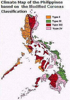
Climate:
The climatographical map from PAG-ASA shows that the climate of the municipality of Naga is of the fourth type wherein by the nature of its geographicallocation and its wide and extensive area, it experience different climatic condition. The southern part is relatively dry from November to May and wet duringthe rest of the year. Its rainfall is evenly distributed throughout the year. Thistype is however, typical and common to the rest of the provinces and localitiesin Western Mindanao. Average annual rainfall for the municipality is 194.70millimeters. Temperature is fairly warm throughout the year. Due to lack of dryseason, the relative humidity from January to May is 80% and 85% from Juneto December. As maybe observed, the highest values occur during wet months.Prevailing wind direction is southwesterly. The occurrence of typhoons in themunicipality is unheard of. The winds experiences in the area are merely theresults of depressions and monsoon winds.
AVERAGE MONTHLY RAINFUL, TEMPERATURE, HUMIDITY, DEW POINT, MEAN CLOUDNESS
|
|
JAN |
FEB |
MAR |
APR |
MAY |
JUNE |
JULY |
AUG |
SEPT |
OCT |
NOV |
DEC |
AVE. YEARLY |
|
RAINFALL (mm) |
100 |
100 |
100 |
100 |
236.40 |
250 |
250 |
250 |
250 |
250 |
250 |
200 |
194.70 |
|
MEAN TEMPERATURE (ºC) |
26 |
26 |
26.5 |
27.5 |
27.5 |
26.5 |
27 |
26 |
26 |
26.5 |
26.5 |
26.2 |
26.54 ºC |
|
MEAN RELATIVE HUMIDY (%) |
80 |
80 |
80 |
80 |
80 |
85 |
85 |
85 |
85 |
85 |
85 |
85 |
83% |
|
MEAN DEW POINT (ºC) |
22 |
22 |
22 |
24 |
23 |
23 |
23 |
23 |
23 |
23 |
23 |
23 |
23 ºC |
|
MEAN CLOUDNESS(%SKY) |
7 |
7 |
6 |
7 |
6 |
7 |
7 |
8 |
7 |
7 |
7 |
7 |
7% SKY |
SOURCE: PAG-ASA, 1980
The people of the municipality traced the evolution of the term “NAGA” to three (3) traditional folklores. The first one believed that the word “NAGA” was coined from a mythological monster with seven heads known as the dragon. This dragon or Naga was believed to have been in existence and lived among the rocks of Singkilon and the thick forest which cover the whole area.

Official Facebook Page
 Like us on Facebook
Electronic Business and Licensing System
 Electronic Business and Licensing System
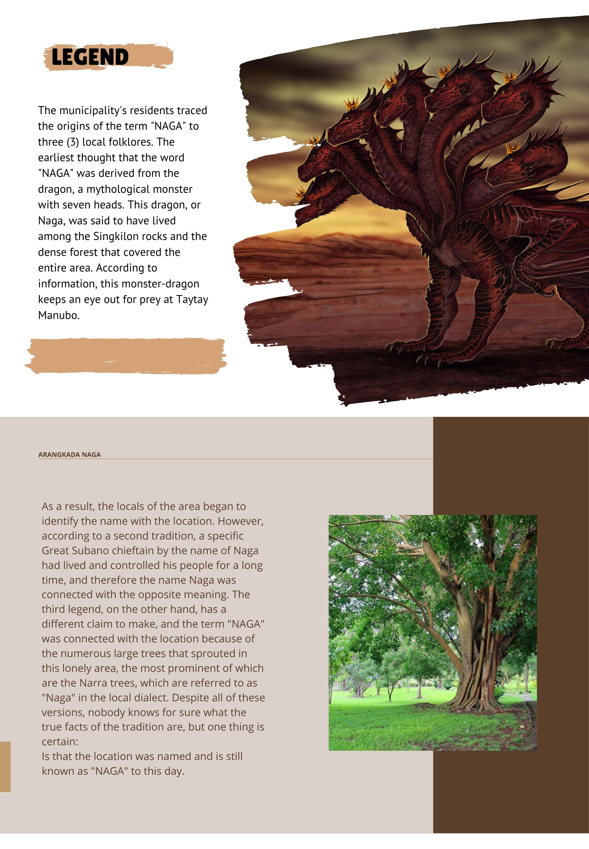